C3-61000 PRO (left) and C2-9000 (right) cameras with
installed GPS receivers GPS modules can be attached to the port on the back side of the C2
or C3 camera head. Please note the camera must be equipped with a
different back shell as well as internal electronic circuits to be
compatible with GPS modules. So, it is necessary to choose GPS-ready
variant upon camera ordering. Adding a GPS later requires the camera
to be sent to manufacturer.
GPS antenna is shipped with the GPS module. Antenna cable is
3 m long and the antenna is equipped with
a magnet, allowing it to be attached to any ferromagnetic surface.
Please note the antenna must have a good view to the sky to be able to
acquire signal from GPS satellites. Placing the antenna e.g. under
metal covered dome may significantly limit the GPS signal
reception.
GPS receiver module handling
GPS module is handled through camera command set. Its main
purpose is to provide very precise timing of the exposure times
with better than μs precision (the GPS module provides time
pulses with 30 ns tolerance).
Geographic location data are also available to the control
software through specific commands.

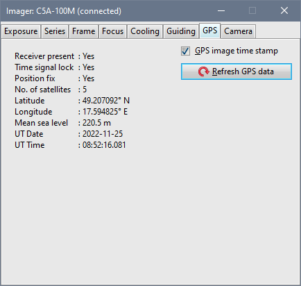
The GPS tab in the SIPS camera control tool window
shows information about GPS receiver state The GPS module needs to locate at last 5 satellites to provide
exposure timing information. Geographic data are available if only
3 satellites are visible, but especially the mean sea level
precision suffers if less than 4 satellites are used.
| 